
Like many other places, Kettering once had several Wash Ponds—shallow pools where horses were brought to be cleaned after muddy journeys or hard labour.
A map of Kettering from 1721 shows us these ponds’ names and locations.
They would have been phased out as horses were replaced by machines, and as the availability of running water improved.
Kettering Waterworks Company was formed in 1871 by John Dryland – ironically, a man called Dryland put the town’s ponds out of business!
Newland Pond
Newland Pond was at the crossroad of Gold Street, Montagu Street, Newland Street, and Silver Street.
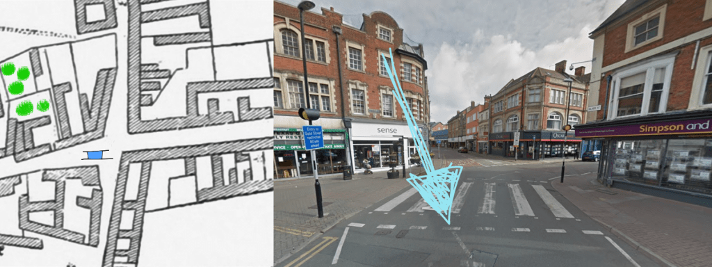
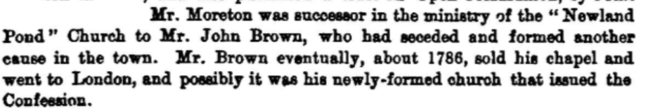
In its time, Newland Pond was apparently a prominent landmark in Kettering – the church which would eventually be known as Fuller Baptist Church was called “the Newland Pond Church“.

Glover’s Pond
Glover’s Pond was approximately in the space between the current McDonalds and Peacocks, at the top of what is now Meadow Road but has been called Gas Street, Mill Lane, and Goose Pasture Lane.

Glover’s Pond was possibly a much-loved or historic pond – the vestry (a bit like a town council) seemed to have trouble removing it. There were two different Vestry Meetings (fourteen years apart) where it was decided that this pond should be filled in.


This wasn’t at a time when wash ponds were being phased out – Glover’s Pond was considered a nuisance, and a replacement Pond was suggested “near the hospital.”
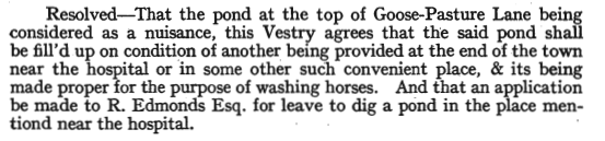
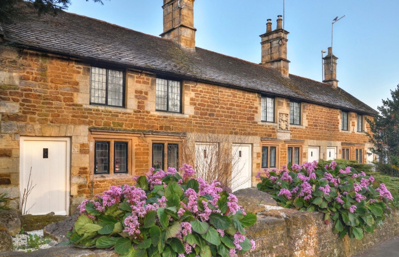
“The hospital” didn’t mean Kettering General Hospital, but Sawyer’s Almshouses.
The Hospital Pond
This was the pond that was made when it was first decided that Glover’s Pond should be filled in.
A Vestry Meeting in 1810 gives us some insight as to how street names change over time, as the pond was described as being on Hall Lane.

But this didn’t refer to the current Hall Lane – the map of Kettering from the 1720s labels the stretch of the current Northampton Road that runs from Sheep Street to Northfield Avenue as Hall Lane!
Northall Pond
Northall Pond was on Lower Street, near the point it meets Northall Street – approximately in front of the Three Cocks pub.

An 1831 Vestry Meeting decided that this pond should be filled in. This was at a time when water services were improving, as they considered replacing the pond with a reservoir system.
Bazley’s Pond
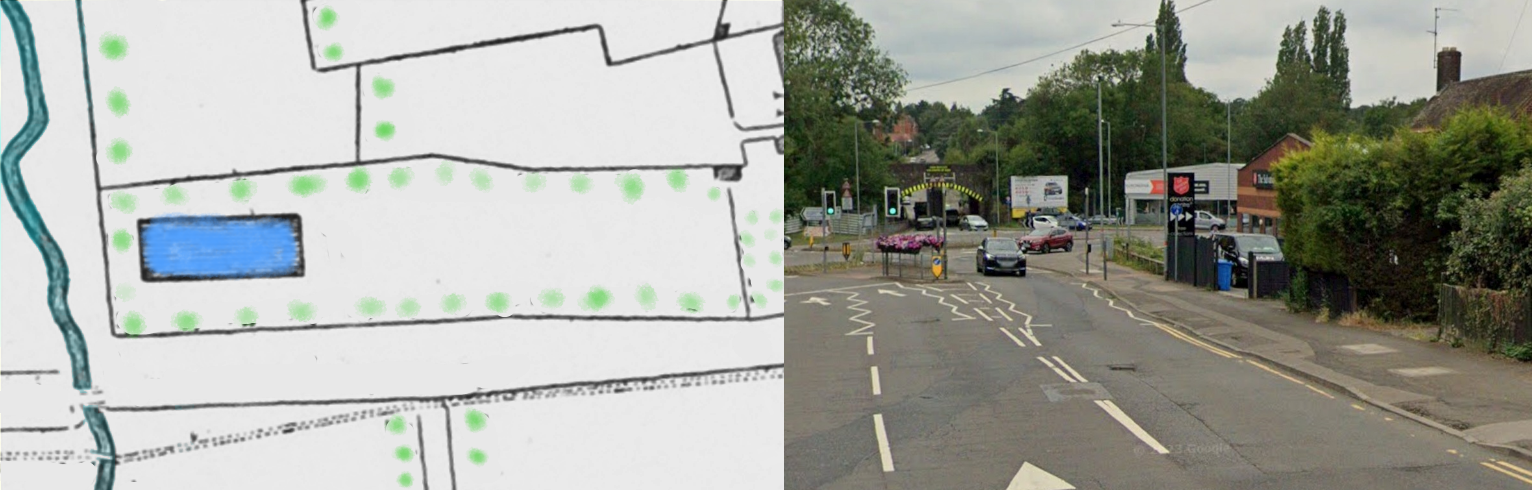
Bazley’s Pond was at the bottom of the part of Northampton Road which was then called Hall Lane, somewhere near the Salvation Army.
This pond was a bit mysterious – it isn’t mentioned in the Vestry Meetings, or anywhere else; its only mention is on the 1721 map. It was likely named after the landowner or farmer who worked the land.
Whatever its story was, it disappeared without a splash!
Sources
https://www.northamptonshirerecordsociety.org.uk
Thomas Eayre’s Map of Kettering (1721)
Kettering Vestry Minutes AD 1797-1853, retrieved from Northamptonshire Record Society. https://www.northamptonshirerecordsociety.org.uk/pdf/volume-6/vol-6-kettering-vestry.pdf
Northamptonshire Notes & Queries, Vol 3 https://archive.org/stream/northamptonshir05unkngoog/northamptonshir05unkngoog_djvu.txt
https://www.fullerbaptist.org.uk/index.php/history/history-introduction (This confirms that Fuller Baptist Church is the one where George Moreton was working.
