

Acres / Roods / Perches
The “a r p” with numbers on this old map represent the traditional land measurement system of acres, roods, and perches (sometimes called poles).
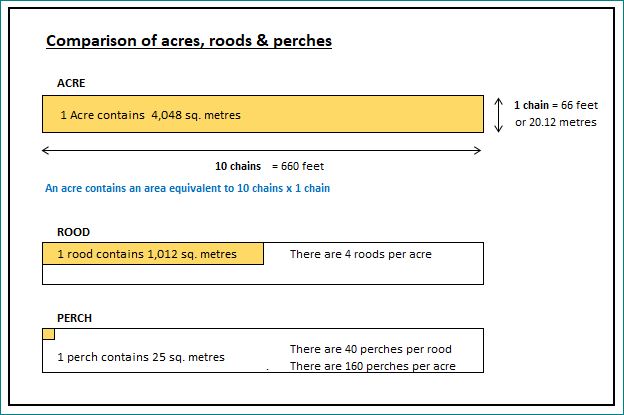
a = acres (1 acre = 4 roods = 160 perches)
r = roods (1 rood = ¼ acre = 40 perches)
p = perches (1 perch = 16.5 feet × 16.5 feet = 30.25 square yards)
So, for example:
Warren Close (a/29 r/2 p/4) means 29 acres, 2 roods, 4 perches.
This system was standard in England before the metric system and is often seen in old estate maps, tithe maps, and enclosure awards.
Note – the a r p acres are the same as “our” acres.
Conversions
Let’s go back to the Warren Close example:
29 acres = 29 × 4,048 = 117,392 m²
2 roods = 2 × 1,012 = 2,024 m²
4 perches = 4 × 25 = 100 m²
Total = 117,392 + 2,024 + 100 = 119,516 m²
In hectares: 119,516 ÷ 10,000 = 11.95 hectares.
