
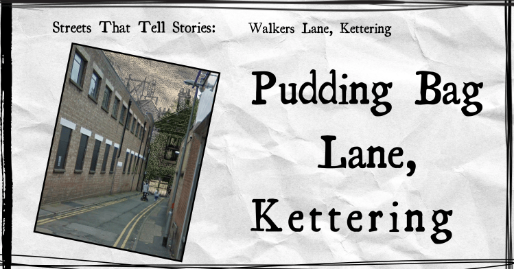
Between B&M and the old M&S building is an alley called Walkers Lane, which leads to the Wadcroft Car Park.

But it wasn’t always called that…
According to the key included with the Kettering Town Map from 1826, it was once named Pudding Bag Lane; so-called because if you went too far along it, you would be trespassing on private land – a bag has only one opening, with a dead end.
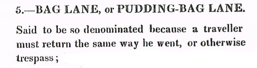
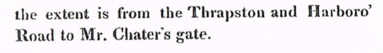
The map key goes on to describe the extent to the private land – between the road to Market Harborough; and the gate on the land belonging to James Chater.
Here is the relevant section from the 1826 map – circled in red is Chater’s Gate; the green line shows Pudding Bag Lane; the road to Market Harborough is labelled.

There are other Pudding Bag Lanes across England, all presumably named from similar reasons.
Also mentioned were two other lanes (Hazlewood and Bridewell) that ended in private yards …
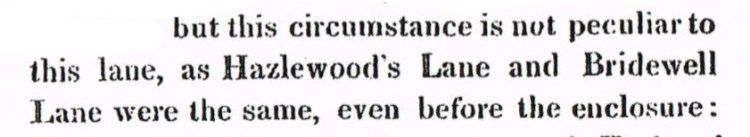
… but the part that caught my attention was “before the enclosure”, so I did some more digging.
See my post about the mentioned enclosure here!
